



UNDATED—(AVC News)–Hurricane Isaias made landfall Friday evening, with the storm’s eye coming ashore near Destin Florida around 8:30 pm EDT.
The Category 2 storm brought sustained winds of 105 mph, but diminished quickly to a Category 1 storm with winds topping out at 85 mph.
By Saturday morning, Isaias was downgraded to a post tropical cyclone.
The first Atlantic hurricane of the 2026 season caused considerable damage, flooding, tornados and caused power outages affecting more than 800.000 in Florida, Alabama and Georgia.
The remains of Hurricane Isais is moving north, bringing gusty winds and rain to the Ohio Valley.
NOAA maps, early Saturday morning, predict the center of the post tropical depression to turn eastward just south of Ohio, centering roughly over Clarksburg West Virginia by Sunday evening.
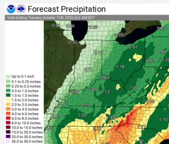
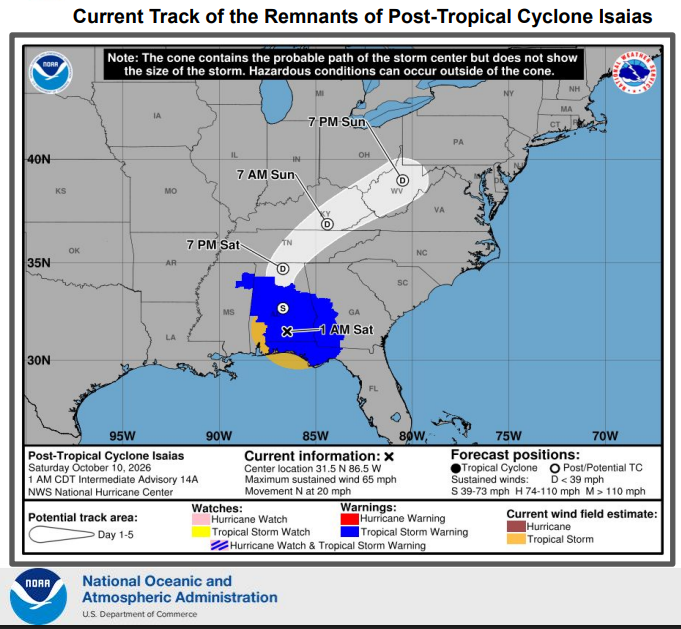
Winds will increase in the region Saturday evening as will the chance of rain.
Wind gusts of upwards of 25 mph are likely in eastern and southeastern Ohio. However, some places could see gusts of 25-35 mph.
Wind Advisories have been posted for portions of W. Virginia and Pennsylvania for Saturday night into Sunday morning.
Showers and thunderstorms are also likely starting late Saturday and through the day on Sunday, tapering off Sunday night.
Rainfall amounts for the eastern part of Ohio are predicted to be just over one inch up to about an inch and a half to 2 inches in some areas before tapering off.
The NWS does not predict any strong thunderstorms but has not been completely ruled out.
The forecast for Monday, Columbus Day, calls for partly sunny skies with highs in the mid 70’s.
Last Updated on October 10, 2026 by AVC News